Welcome to Sapphire

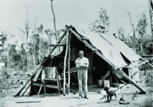
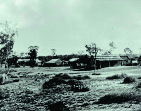
On Retreat Creek, 10 kilometres north of the Capricorn Highway, is the small township of Sapphire. 

Precious stones were first discovered here by surveyor Archibald John Richardson in 1873, and by 1890 a washing plant was erected at Retreat Creek Camp to treat the gem-bearing wash. Word quickly spread, bringing treasure hunters from far and wide and by 1905, Sapphire was declared a town.

→

Every mining camp needs a watering hole so in 1903 a building was transported from Comet and soon opened up as Kitchener’s Hotel. A second hotel, Sylvester’s, was established in 1904. 

→

Sapphire became a destination for gem lovers from all over the world after a valuable Queensland sapphire collection was displayed at the Franco-British Exhibition in London in 1908. For six months the eyes of London were dazzled by the display.

→

With a fast growing population, other basic amenities emerged such as a first aid station, a school, a hall, a cemetery and a racecourse.

↓

The local population continued to grow and in 1914 the land surrounding the townships of Sapphire and Rubyvale was declared a Miners’ Common, allowing residents to graze stock freely. 

→

During the 1920s, Sapphire’s population fell dramatically, and real recovery did not come until the 1960s. 

→

Since the early 1900s, fortunes have been made and lost and many people have become hooked on the laidback, casual charm of the area.

→

Despite some residents being content to be self-sufficient, electricity was connected in Sapphire in 1977 followed by piped (or reticulated) water in 1998.

→

Take the time to discover the township of Rubyvale, nestled beside Policeman’s Creek only 6 km further along this sealed road.

↓

Sapphire gemfields wetland reserve 

Explore the Sapphire Gemfields Wetland Reserve, a seasonal wetland representing the meeting of two habitats – land and water. Take your binoculars and camera and use the bird hide. In the wetter seasons, take a walk along the boardwalk to view the unique water bugs, water lilies and Nardoo plants.
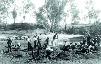
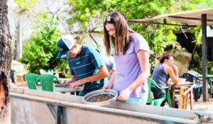
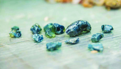
If you are keen to find out what fossicking fever is all about, we recommend you purchase a bucket of wash from any of the local fossicking parks and try your luck. Friendly staff will provide advice and guidance on how to sieve and identify sapphires.

follow the trail

sapphire gemfields geo-interpretive trail

The Sapphire Gemfields Geo-Interpretive Trail is a series of storytelling signs that lead you on a colourful journey through Anakie, Willows Gemfields, Sapphire, and Rubyvale.

→

Each town has a central node with a map that indicates where to find nearby interpretive place markers, which detail the fascinating past and present of our unique part of the world.

→

All you need is a vehicle and an appetite for adventure! 

Learn about: 
> famous gemstones 
> characters and capers 
> booms and busts 
> fossicking 
> geological marvels

↓

find your way 

Download what3words to easily navigate between the Geo-Interpretive Trail nodes and place markers. This app can work offline and gives each location a unique three-word identifier, bypassing the need for street names and an internet connection. Simply enter your next destination’s identifier (each sign lists its three closest signs) and follow the app’s directions. Learn more about using what3words at centralqueenslandhighlands.com.au

↓

Fossicking & camping 

Fossicking is allowed at Fossicking Areas and Designated Fossicking Lands but you must first buy a fossicking licence online at qld.gov.au or from authorised local agents.
Licences are not required at tourist mines and similar sites that charge an entry fee.
You will need a fossicking camping permit to camp in Fossicking Areas and Designated Fossicking Lands. These are available through the same outlets. 

What’s the difference?

Fossicking Areas and Designated Fossicking Lands are both open to anyone with a current fossicking licence. While Areas are reserved exclusively for recreational use, Lands also permit commercial mining to take place nearby.
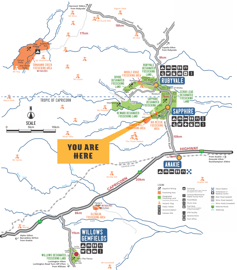
heard of geocaching? 

Geocaching is a treasure hunt with something for everyone. Using map coordinates and a GPS-enabled device, you can find a geocache near your home – in the city or the country. Even in Antarctica! Geocaches (geo meaning earth, and cache meaning hidden treasure) come in all shapes, sizes and skill levels. Our Geo-Interpretive Trail is set amongst an array of geocaching locations. The sites can be found at geocaching.com.au.

↓

what3words

Download the what3words app to help you follow the Trail.
Here are the ///what3words identifiers for this location and for the three closest stops:

You are here: ///totals.treat.condoned

Where to next?

Miners’ Common – Sapphire///upbringing.restricting.songs

Centenary Stone – Sapphire///sufferings.moats.upstage

Piano Tuner’s Grave///occupier.unexplored.stunned

Scroll to Top